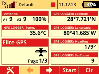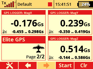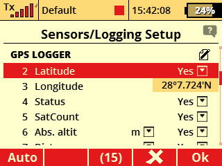
The GPS LOGGER is a telemetry device that offers fast and accurate real-time position detection, data logging
and telemetry real-time downlink. It uses multiple satellite navigation systems to achieve maximum precision
and resolution. Logging of all the data is possible due to its large integrated Flash memory.
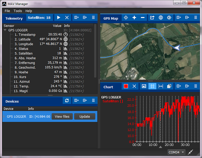
The logged data can be downloaded and analyzed on a computer using the free MAV Manager software. Simply
Plug & Play solution for your Jeti, Futaba or Graupner RC System. Due to file sizes and data
transfer speed we recommend using Elite USB Programming Interface Adapter (MAV) for data uploads.
Installation
Connect the GPS LOGGER to the receiver telemetry port. Place the device on top of the plane, so
that the internal patch antenna is not shielded in any direction. Shielding materials, such as metal, carbon or
anything conducting, can reduce the performance of position detection. Additionally, make sure that
the 2.4GHz antennas are located at least 8" (200mm) or more from the GPS LOGGER. Try to avoid any mechanical stress
on the sensor and avoid any close contact with components producing heat (such as engines or speed controllers).
Use a soft double-sided adhesive tape, or Velcro as an alternative.
Specifications and Features
- Large industrial memory for data logging (256MB).
- Latest generation GPS chipset supporting multiple satellite systems.
- 3-axis magnetometer/compass for external navigation purpose.
- Backup supercapacitor for fast position fix after powering off.
- Automatic telemetry detection: Duplex EX, Hott, MSB, S.Bus2.
- Automatic time zone detection.
More information (links):
* Instruction Manual (pdf.)
* GPS App QuickStart Guide (pdf.)
* Click Here for Firmware Updates & MAV Manager
Compatibility: Jeti EX, Multiplex M-LINK, Graupner HoTT, Futaba S.Bus/S.Bus2
Positioning Systems: GPS, GALILEO, GLONASS
Data Recording Time: Up to 66 Hours (5 samples/s)
Operational Voltage: 3.5V to 8.4V
Dimensions/Weight: 28mm x 30mm x 9mm/14g
Parameters: Latitude/Longitude, Distance, 2/3D Speed, Azimuth, Heading/Course, Altitude
Programmable: Using JetiBox, JetiBox Mini and JetiBox Profi
|
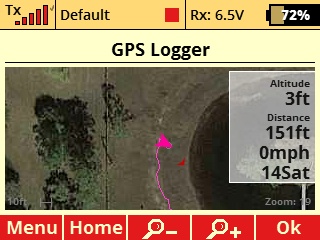
Live Position with Map Overlay
See the current model position directly on the map, easily zoom in or out. Track altitude, speed and
distance, in real time, from the home screen of the transmitter. Easily locate model in relationship
to the local topography. Very important when flying in a restricted environment with strict boundries.
|
|
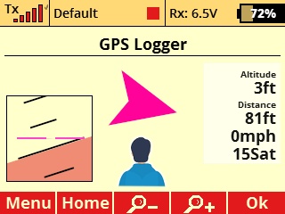
Navigation and Artificial Horizon
Voice & Visual navigation directly on the screen. Azimuth with heading for return home in case of emergency, or
loss of sight of the model. If you ever get lost while in the air, you can get back home by following the arrow
on the screen and listening to the voice directions. Add Jeti Assist Receiver or EX5 Stabilization and get
the artificial horizon for spatial orientation.
|
|
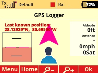
Last Known Position
Disaster strikes, lost your model? Our telemetry system can always help. Elite GPS will display live
on the screen of the transmitter your models last known position. Data is preserved even in case of
power interruption at the model. Fast refresh rates ensure that the location shown is accurate to
the position of the unintended landing site.
|
